
If you’ve been thinking of exploring New Zealand, one of the best road trips is to drive the East Cape.
Not only does the East Cape drive have spectacular coastal views, stunning beaches, native fauna, and bush walks, but it also gives you a glimpse of being transported back in time to rural New Zealand.
And one of the best ways to explore the East Cape is with freedom camping.
And the reason?
Without the huge cost of accommodation, freedom camping gives you time to extend your road trip. There’s no rush to be at the booked accommodation. You have the freedom to stay longer in one place if it appeals. You can get up and leave when you want.
And it’s definitely worth taking at least 10 days to explore the East Cape with freedom camping.
Check out TravelKiwis Shop for your New Zealand 2024 Bird Calendar.
A drive of the East Cape is around the iconic State Highway 35 (SH35), which has two options:
- Drive the coast from Opotiki to Gisborne
- Drive inland from Gisborne to Opotiki
You can also add on the SH2 drive from Opotiki to Gisborne through Waioeka Gorge.
SH35 meanders through many small towns rich in stories of early New Zealand. You’ll see Maori meeting houses (Marae) with carved gateways, early European buildings, abandoned wharves and warehouses.
And it’s up to you how often you want to stop.
Because here in the East Cape, you can easily let yourself be immersed in the slower pace of life. Like the Coromandel Coast and the South Island, the East Cape is a region of New Zealand you’ll want to take your time to explore.
You might be adding this road trip to a much bigger travel adventure around New Zealand. But, if the East Cape is a destination trip, you can start your journey with a flight to Whakatane or Gisborne.
So what is Freedom Camping?
Freedom camping is camping in a tent, caravan, campervan or motorhome on a designated area of public land. Controlled by a local council, they provide information on freedom camping rules.
Usually, there are no facilities, although some designated areas do have a public toilet. In peak season, some freedom camping places require payment of a fee or permit.
For example, you pay a fee at the Anaura Bay Department of Conservation (DOC) campsite or buy a permit for Tokomaru Bay in peak season.
You will be responsible for your own rubbish removal, which is noted on the relevant council website.
Some Freedom Camping sites in East Cape:
- Opoutama Beach (near Mahia Peninsula)
- Tolaga Bay (near the beach)
- Tokomaru Bay (2 nights maximum, permit required in peak season)
- Lottin Point
- Te Kaha Bay (borders SH35, maximum two nights)
- Te Ahiaua (Pipi Beds), 8km west of Ōpōtiki
- Hukuwai Beach, 2km east of Ōpōtiki
To avoid Freedom Camping fines, check the regulations for Freedom Camping in each district:
Our favourite freedom camping place was Opoutama Beach.
We had the beach at our door for early morning walks and safe swimming. The stargazing without light pollution was spectacular. But finding an injured and stranded whale one morning was upsetting. Everyone was on hand to help.
How to Benefit from Freedom Camping
A checklist for Freedom Camping:
- Visit the relevant Council website in the area you are visiting
- Read the rules as each Council can vary on their requirements
- Ensure you display a valid Self Contained certificate on your vehicle
- Check freedom camp signs displayed for the maximum number of nights
Away from the summer months, it’s not too difficult to find space and peace along the East Cape’s shores. It takes the hassle out of planning how long you want to stay in one place.
Take the advantage of spending less of your travel budget, try freedom camping.
How long does it take to drive around the East Cape?
The East Cape drive is 326kms (approx. five hours) to drive SH35 from Gisborne to Opotiki (if you google the distance.) Many people do this drive over a long weekend, but we recommend slowing down and taking more time.
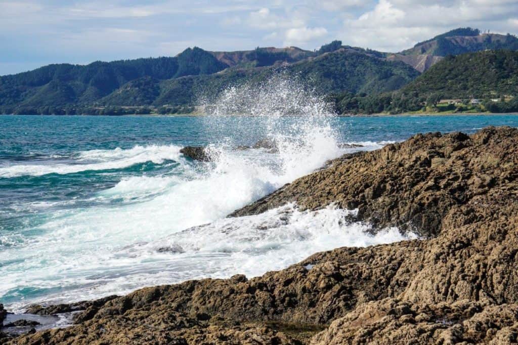
SH35, at times, is narrow and windy. There are some spectacular views of the pristine and rugged coastline as you head east away from Opotiki. And the drive east from Gisborne takes you inland, winding up hills for scenery.
Allow yourself extra time to stop and admire the views, to navigate the road conditions, especially around those sharp corners.
East Coast Road Conditions and Tips:
- Roads can be narrow and windy
- Logging trucks are frequent in forest areas
- Cellphone coverage is patchy in certain areas and non-existent in others
- Find Four Square grocery stores in most settlements
- Use a fuel app to find petrol/diesel stations
Freedom camping is available in many locations.
Where Should you Stay in the East Cape?
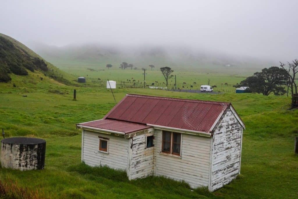
Maybe not this old rural hut because you have better options:
- Airbnb
- Hotels/Motels
- Bookabach
- Campsites
- Freedom Camping
If you are travelling the East Cape by car, various lodges in the small bays or towns along SH35 may have deals when you book using Hotels.com.
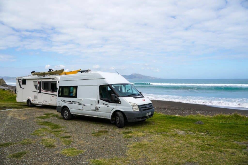
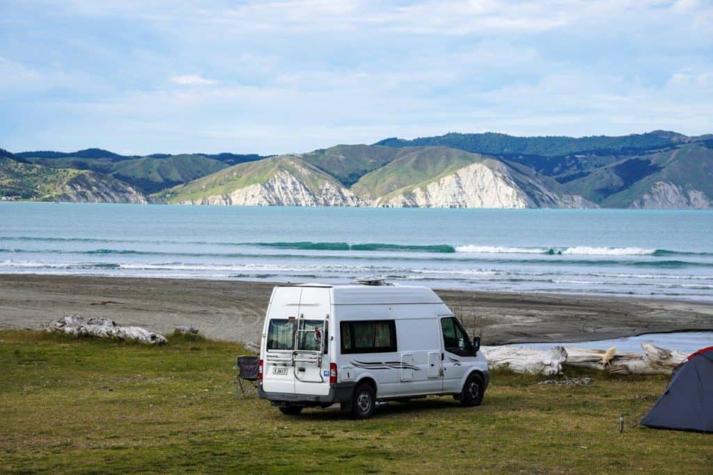
Our preference was to use freedom camping to explore the East Cape, with a mixture of paid campsites. Our campervan was easy to drive, the height allowed us to view more, and it provided self-contained accommodation.
We used a powered site twice for our nomadic work and our early morning drive to the East Cape lighthouse. Otherwise, we topped up the power of our self-contained campervan every few days driving between places.
Freedom camping is one of the best ways to experience an East Cape road trip.
So, what will you find at the freedom camping stops along SH35?
Highlights of Driving the East Cape
With so many remote headlands, exquisite coves, windswept settlements, to places off the beaten track, you can pick and choose the places you want to stay driving the East Cape.
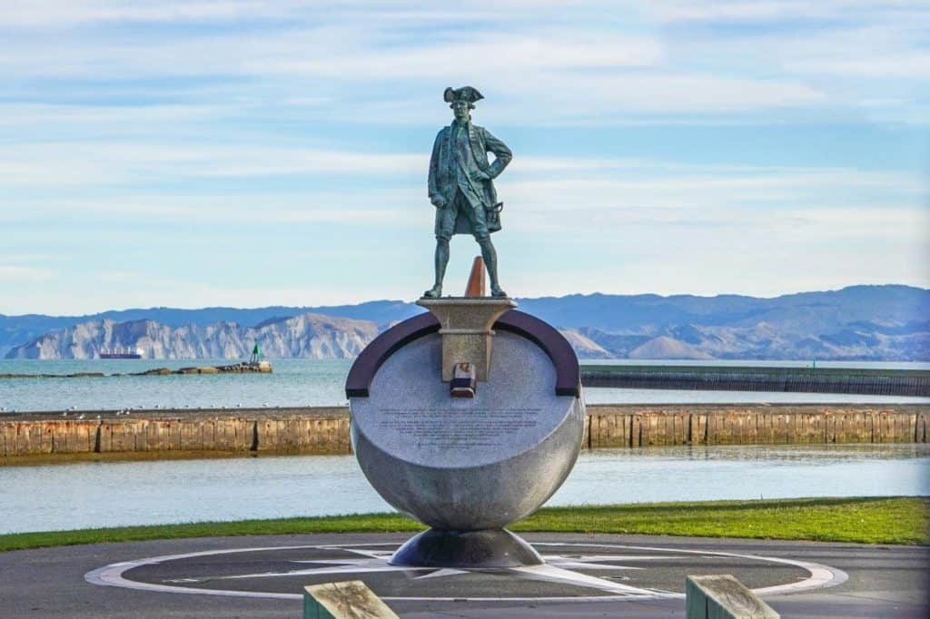
Our road trip started in the art deco city of Napier, in sunny Hawkes Bay.
With its surrounding beaches, annual Art Deco Festival and numerous wineries, Napier is a wonderful city to add as a starting point to your road trip to the East Cape.
It has one of the warmest climates in New Zealand, so blue skies and sunshine are often the order of the day.
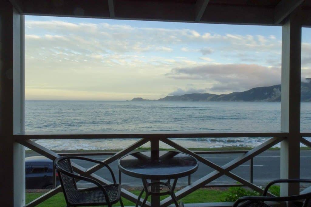
Napier Freedom Camping – BMX Pump Track carpark, Marine Parade
Situated on the beach foreshore, the parking area is on the tarmac with access to a public facility. The carpark is an easy walk to the main centre.
So, after sampling a Hawkes Bay wine list, here’s a list of places to visit when you drive the East Cape.
Freedom Camping East Cape Things to Do
As we love walking trails, we have added walking and cycle trails to our suggestions for things to do on the East Cape.
Mahia Peninsula
From Napier, we drove the 117km to Wairoa in 1 hour and 45 minutes. We stopped there for some extra supplies before driving another 35 minutes to Opoutama Beach near Mahia Peninsula.
Opoutama Beach is a tranquil spot with safe beaches for swimming, waves for the surfers and walks along the old railway line to the old port.
However, railbiking is a new adventure for the adventurous. Sitting side by side, you can cycle the old train lines along the rocky coastline.
And make sure to drive the eastern side of the Mahia Peninsula. The fishing is good, and the rock formations are unusual. Plus, the climb up Mokotahi Lookout for views of the bay below is well worth the effort.
The best spot for freedom camping near Mahia is Opoutama Beach, which has plenty of space and public toilets.
And if you need to rest those muscles after a long beach or hill walk, book a soak at the Morere hot springs.
Morere Hot Springs
Who can resist the warmth and soothing waters of a hot spring?
Surrounded by native bush, you can soothe the body in the mineral waters. Or take a walk on one of the bush trails. Unpack a picnic lunch in the expansive grassy area.
Morere is a welcome break on the road to Gisborne.
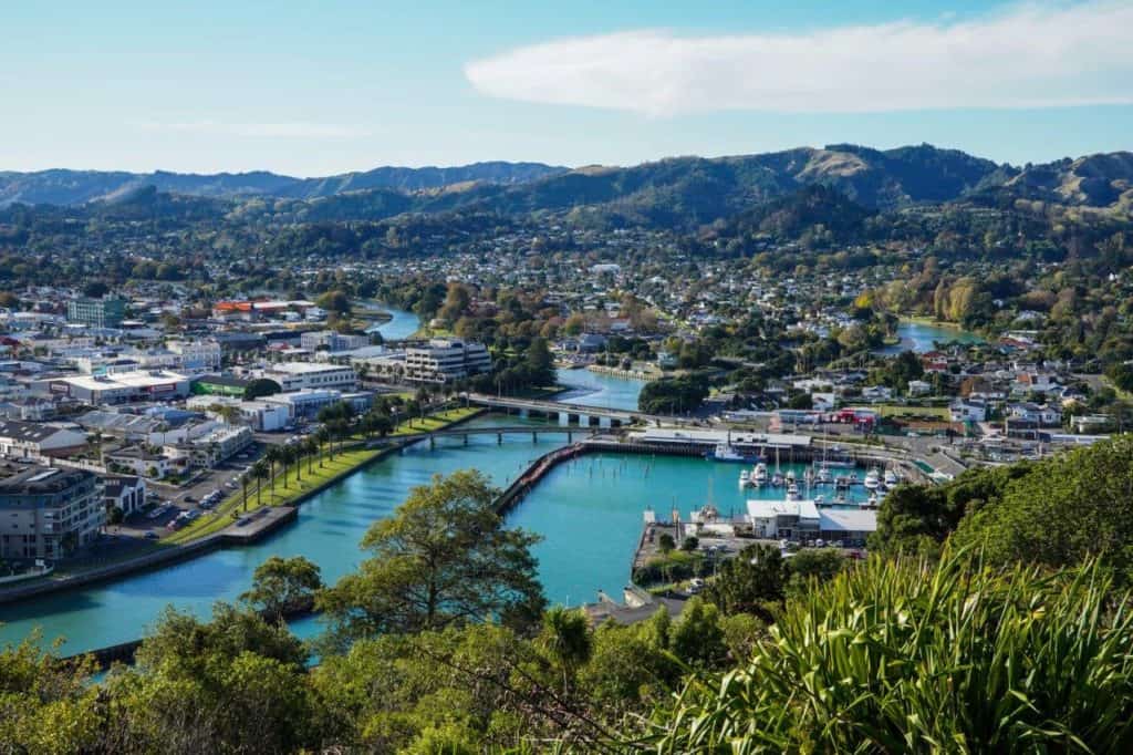
Walk or Bike the Trails of Gisborne
The city of Gisborne is within the Tairawhiti region. And a visit to the Tairawhiti Museum will give you an insight into the early settlement history of both Maori and Europeans.
We enjoyed the historical landmarks of the Tupapa Heritage Trail. Leading from Waikanae Beach and heading up to Kaiti Hill in the Titirangi Reserve. You can drive, walk or hire a bike depending on your energy levels.
The trail crosses over the Turanganui River to the summit of Kaiti Hill. Bring the camera for aerial views of the city and coastline. And on your return, make a stop at the Gisborne Wine Centre along the inner harbour. You can sample a selection of Gisborne wines with a tasty food platter.
Gisborne is an active city that can be used as a base to explore the surrounding trails and beaches. Further along the coast are Wainui Beach and Tatapouri Reef Ecology. Take a guided tour to interact with stingrays.
But if you dive or snorkel, drive to Pouawa to access the Te Tapuwae o Rongokako marine reserve.
Gisborne Freedom Camping – Makorori Beach Road (close to Tatapouri Reef Ecology)
Gisborne Freedom Camping – Kaiti Beach Road (we wouldn’t recommend it as close to Gisborne Port for logging trucks)
Or, continue your drive from Gisborne to Tolaga Bay (54 km).
Explore Cooks Cove at Tolaga Bay
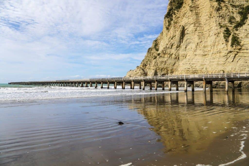
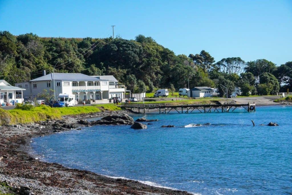
Before you arrive at the township of Tolaga Bay, turn right for a stop at the Tolaga Bay Wharf.
The wharf, built in 1929, is a Category One Heritage NZ Site and one of the top 100 historical sites to visit in the country. At 660 metres long, it is believed to be the longest wharf of its type in the Southern Hemisphere.
The wharf is open to the public to walk out into the bay for up-close views of the surrounding cliffs. You can leave your vehicle here at the wharf or drive the two minutes to Cook’s Cove Walkway entrance.
Walk to Cook’s Cove
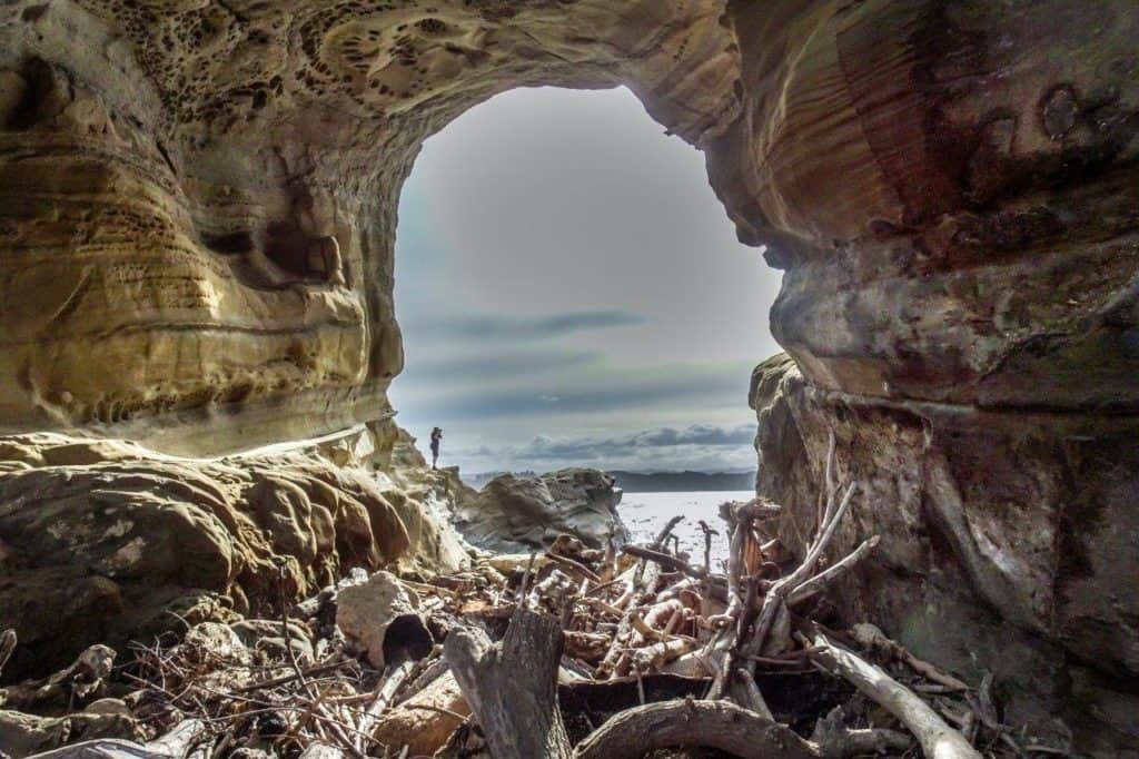
You’ll want to allow an hour or two for the return walk unless you stay longer for a picnic. The walk is 2.5 km one-way over farmland and down through the native bush. Some of the terrains are steep, and a decent level of fitness is required.
Your first stop on the Cook’s Cove Walkway will be the Beacon of Light, a 12-metre Te Pourewa sculpture lit at night and visible from Tolaga township. This part of the walk is farmland, taking you to a lookout over the Cook’s Cove below.
If your fitness levels are low, this is a good return point. Otherwise, the walk down through the native bush to Cook’s Cove is alive with birdsong, and it emerges at the Hole in the Rock.
Then, it’s only a short walk from here to Cook’s Cove beach, where Captain Cook came ashore.
Tolaga Bay Freedom Camping (Blue Waters Freedom Camping) – Ferneaux Street
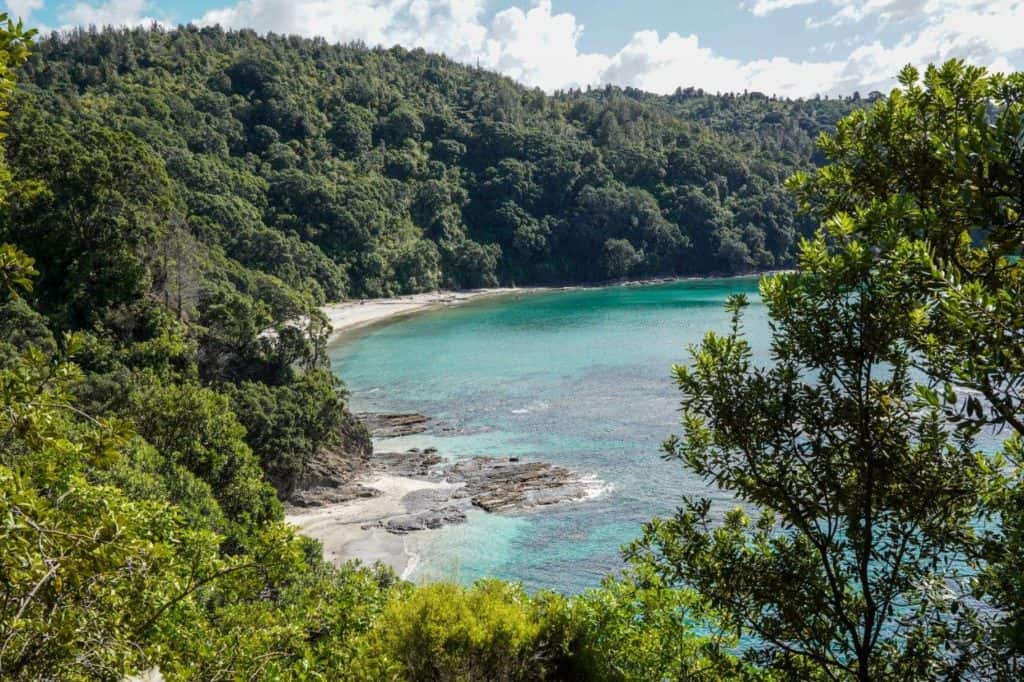
Or an alternative is to travel another 20 km to the picturesque Anaura Bay.
Escape to Anaura Bay
Anaura Bay is a drive of 8.7 km from the turn-off of SH35, a remote settlement in the off-season.
It’s a secluded bay with a paid campsite at the old school. Or the DOC campsite opens during daylight saving (Labour weekend to Easter weekend).
The DOC campsite is popular in summer as it is close to the entrance to the Anaura Bay Walkway. A loop track through native bush, over farmland and crossing over streams. Allow two hours to take in the scenic view of the bay and crystal blue water.
For current fees and campsite rules, visit the website Anaura Bay Campsite.
And when you feel it’s time for someone else to do the cooking, head to Tokomaru Bay.
Dine-in at Tokomaru Bay
On the 30km drive to Tokomaru Bay, look out for the wild and farmed goats, often sharing a paddock with paradise ducks. The surrounding farmland had easy access to the freezing works at Tokomaru Bay during the 1900s.
A drive through the town will lead you to an old wharf and brick cargo buildings that closed in 1963. You can enjoy swimming in the 8kms of beach, or maybe do some fishing. End the day with a drink or meal at the local tavern.
The Te Puka Tavern has provided hospitality to travellers and locals since it was established in 1873.
Freedom camping is a maximum of two nights, and in peak season, a permit is required. Here’s more information on East Cape freedom camping.
Tokomaru Bay Freedom Camping – Beach Road (opposite Potae St) or Waiotu Road
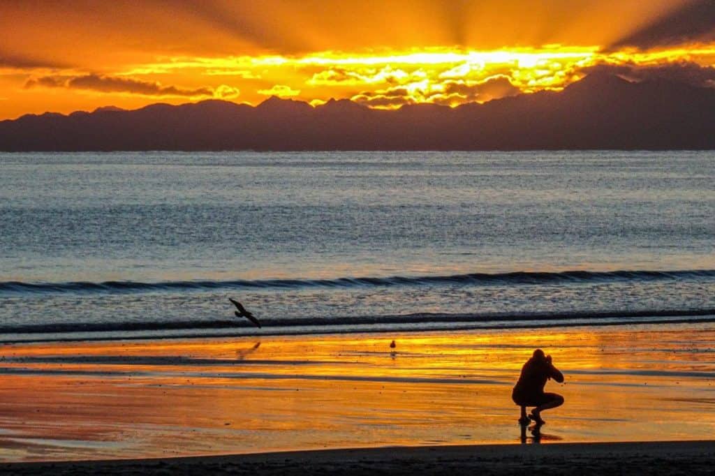
But to see the first rays of sunlight, the next stop has to be the East Cape lighthouse.
See the Sunrise at East Cape Lighthouse
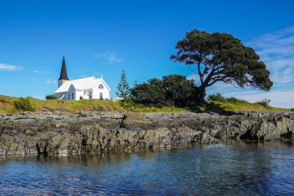
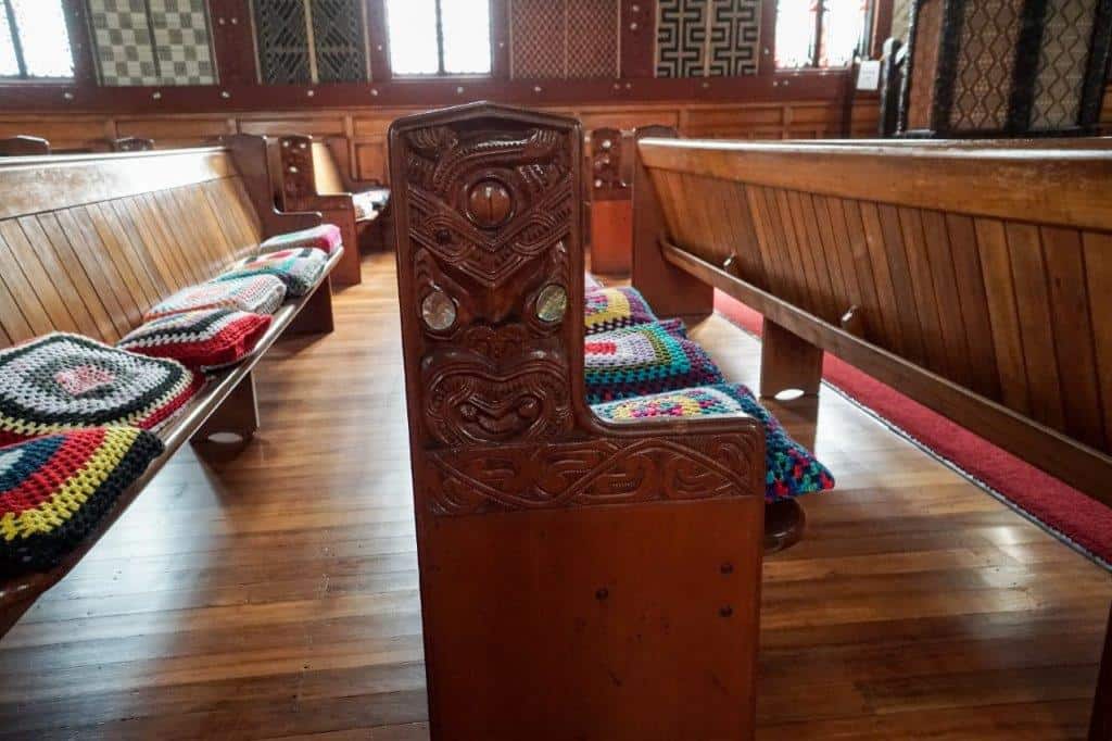
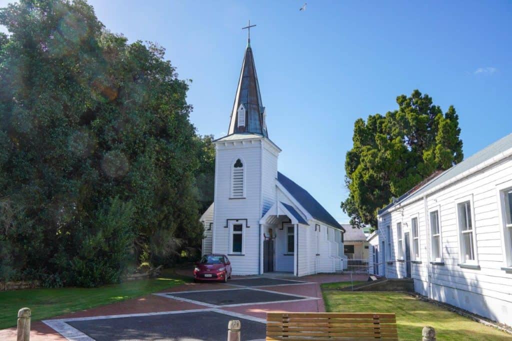
The drive north from Tokomaru Bay will take you past the historic St Mary’s Church at Tikitiki. Take a peek inside to see the detail of ornate Maori carvings.
If you decide not to detour via Ruatoria, another famous stop is the ancient Pohutukawa tree at Te Awaroa.
At Te Awaroa, you can stock up on groceries and fuel before the drive to the East Cape Campground. This road is narrow, with unsealed parts, so be prepared to give way to oncoming vehicles.
The coastline is rugged, the road scattered with wandering cattle, sheep and horses. And the East Cape Camp Ground is perfect for the early morning drive to the lighthouse.

East Cape Camp Ground is a large paddock with a toilet and shower building. There is an honesty box for overnight cash payments or bank transfers. And it’s only 6.5 km to the East Cape Lighthouse.
East Cape Camp Ground – E Cape Road – 13.6kms from Te Awaroa Four Square
The East Cape Lighthouse is situated at the most easterly point of mainland New Zealand. It is one of the first places to see the rising sun.
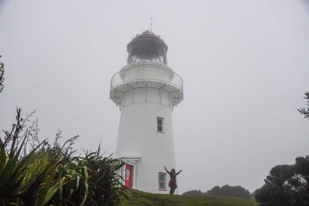
The entrance to the lighthouse is the farmhouse gate on the left of the road before the carpark. Walk past the farm buildings to the bush track behind, up the 800 steps up to the lighthouse for the first rays of daylight.
Go for Breakfast at East Cape Manuka Cafe
After such an early start, there is plenty of time for breakfast at East Cape Manuka Cafe at Te Awaroa. Then if you feel like an early morning swim, Onepoto Bay at the south end of Hicks Bay has a safe swimming beach.
But if you are keen on doing some fishing, make a stop at Lottin Point or Waihau Bay.
Try Fishing at Lottin Point or Waihau Bay
We were travelling with good friends who love their fishing, so Lottin Point was our next stop.
To get to Lottin Point, take the road from Potaka. Grit your teeth as you drive over cattle stops, preventing stock from wandering. It’s all part of the experience.
And hold your breath as, at times, the road is narrow, some parts unsealed, and the final access quite rugged.
Lottin Point has a reputation as one of the best fishing spots on the East Cape.
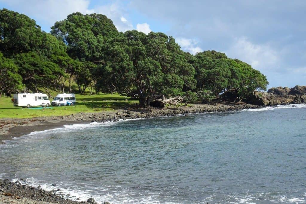
Freedom Camping at Lottin Point
The Lottin Point freedom camping area is small, with a lot of uneven ground. And having to navigate the massive ‘dumps’ from the roaming Water Buffalo was a challenge.
However, the bay is sheltered and framed by a rocky shoreline. Boats and kayaks can be launched for fishing further out of the bay.
We stayed one night and then made our way to Waihau Bay.
Lottin Point Freedom Camping – end of Lottin Point Road
Try Big Game Fishing at Waihau Bay
The drawcard to Waihau Bay is the big game fishing. Otherwise, it’s a quiet place to book an Airbnb for a short break.
The Waihau Bay Lodge offers accommodation, a cafe and a restaurant. And next door is a small paid campsite handy to the wharf for fishing.
But if fishing is not your thing, then the drive from Waihau Bay to Opotiki will have you stopping for photo opportunities.
Gaze at the Amazing Scenery on SH35 to Opotiki
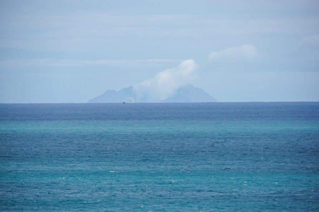
One of the best sections of SH35 on the East Cape drive is from Opotiki to Waihau Bay. As you drive the pristine coastline, you can view White Island (Whakaari) in the distance as you look down on white sandy beaches.
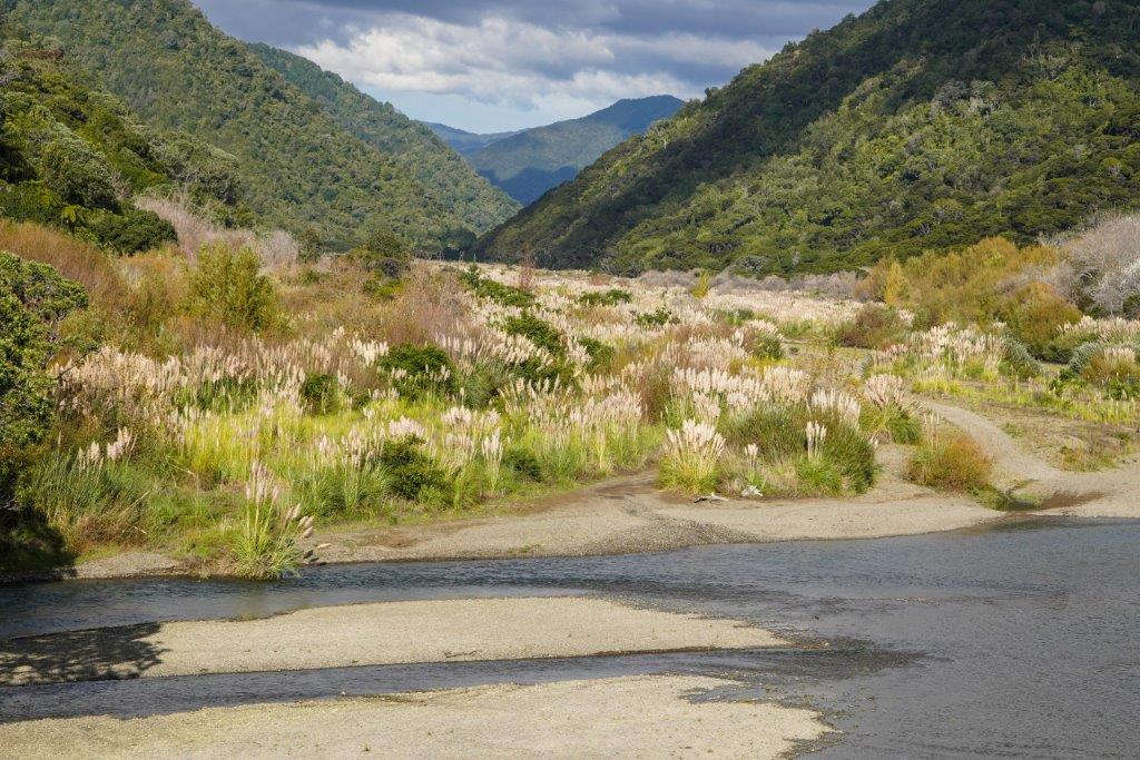
The bridges of the Raukokore River and Kereu River cross the valleys that snake down from the Raukumara Forest Park to the sea. The large riverbeds are covered with toi tois.
Even though Google says it takes one and a half hours from Waihau Bay to Opotiki, the travelling distance is 102kms with windy and narrow roads.
So to devote more time to this area of the East Cape, stop off at either:
- Maraehako Camping Ground (Paid campsite) or
- Te Kaha Freedom Camping
- Hoani Waititi Memorial Reserve
Our preference would be Maraehako Camping Ground, which is close to the beach but sheltered under trees.
Freedom Camping Te Kaha – Maraetai Bay, SH35 (look for Freedom Camping signs by white barrier fence)
Freedom Camping Omaio – Hoani Waititi Memorial Reserve, Omaio Beach Road, SH35
Unfortunately, the Te Kaha Freedom Camping is relegated to an area against the road barrier of SH35. And with truckers who enjoy blasting their horns at 5 a.m., it’s not an ideal freedom camping spot.
We wouldn’t stay there again. Freedom camping near Opotiki is a better option.
Find Popular Trails and Picnic Spots in Opotiki
Because we love walking, we checked out the walking trails in and around Opotiki at the local i-Site centre. Their suggestions included:
- Stop Bank Walkway
- Hukutaia Domain
- Marawaiwai Scenic Reserve
- Ohiwa Harbourside Trail
Our favourite walk was Hukutaia Domain, 8 km from Opotiki. It has some of New Zealand’s endangered plant species and the 2,500-year-old Puriri Tree. The Puriri Tree was once the burial place for local iwi.
The Marawaiwai Scenic Reserve is a walk through the Kahikitea forest built by local college students. It’s a 20-minute drive from Opotiki.
Our least favourite trail was the Tautarangi Coastal Walkway. We never completed the walk because of the small stream littered with rubbish and old metal pieces. Not enticing at all.
Opotiki Freedom Camping – Hikuwai Beach SH35 or Te Ahiaua Reserve – SH2
What to See in Opotiki
Opotiki is surrounded by two rivers, the Otara and the Waioeka, which makes the Stopbank Walkway a good introduction.
The other is the Opotiki Heritage and Agricultural Museum. Here, you have an informative history of the people and the sustainability of Opotiki throughout the centuries.
For bike enthusiasts, the Motu Trails along the Dune Track explore the coastline near Opotiki.
Opotiki Freedom Camping – Hikuwai Beach Freedom Camping SH35
Stop for a Walk at Waiotahe Beach
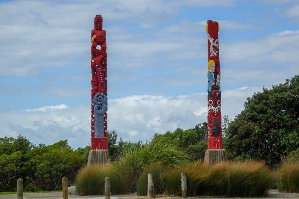
North of Opotiki, Waiotahe Beach is a long stretch of beach where you can walk. At the entrance are two large carved poles, “Te Ara Ki Te Rawhiti” meaning The Pathway to the Sunrise.
Magnificently carved pillars depicting the story of Maori and Pakeha of Opotiki.
But not to be missed, 15km down the road from Opotiki is the Ohiwa Harbourside Trail. There are two walks:
- Ohiwa Harbour Walkway
- Ohiwa Trail
Both walking trails have coastal views near the estuary of birdlife species of heron and weka. Give yourself 1-2 hours for either walk.
We preferred the Ohiwa estuary walk to the salt marsh walk at Nukuhou. A walking trail next to the Pacific Coast Highway on the way to Ohope Beach.
Opotiki Freedom Camping – Te Ahiaua Reserve (The Pipi Beds) SH2
Hear Kiwi at Ohope Beach
We decided to take an extra few nights to drive the Pacific Coast Highway from Opotiki to Ohope.
We had a choice of three places for freedom camping in Ohope, each with a maximum two-night stay:
- Maraetotara Reserve
- Port Ohope Boat Ramp
- West End Reserve (except 3rd week of December to 31 March)
Our favourite spot was at West End Reserve, Ohope.
Waking up to colourful sunrises, taking early morning swims and listening to Kiwi calls every evening. But discovering Otarawairere Bay with its crystal clear blue water and white sand beach. Breathtaking.
It reminded us of New Chums Beach near Whitianga on the Coromandel Peninsula.
As you relax with a wine or a beer, just after sunset, the Kiwi start calling.
Near West End Reserve is the Ohope Scenic Reserve and The Fairbrother Loop track. If you want to be adventurous, plan a night walk of the 2km circuit through native bush with glow worms; Kiwi calls sheet web spiders and wetas.
You can do the walk yourself, or you can book a guided night walk.
We used an online map, but we found the points of interest difficult to locate. Make sure to bring a torch, and a great suggestion is to navigate the track during daylight hours first.
Visit the Whakatane i-site, where staff are very informative about walking and bike trails around Ohope.
Having extended our stay at Ohope Beach for three nights, it was time to drive SH2 from Opotiki to Gisborne (142km).
Drive Waioeka Gorge from Opotiki to Gisborne
An East Cape road trip is a memorable addition to drive SH2 through the Waioeka Gorge Scenic Reserve. This reserve is the traditional land of Ngati Ira. Along the route of SH2 are many ancient Maori pa settlements.
If you drive from Gisborne to Opotiki, the road is along the river’s edge for photo opportunities. But if you are travelling from Opotiki to Gisborne, one stop not to miss is the Tauranga Bridge.
Walk the Tauranga Bridge
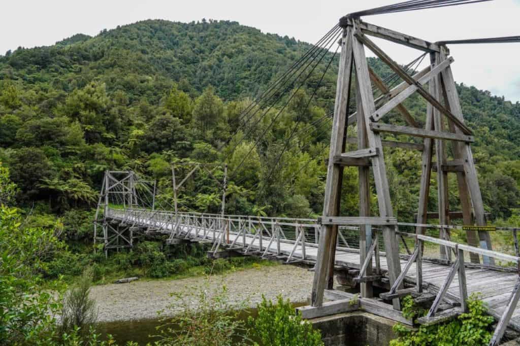
Tauranga Bridge is 25km from Opotiki or 115km from Gisborne. There’s a loop track for walk enthusiasts of 2-3 hours. Or a picnic stop after a walk across the iconic bridge.
The bridge built in 1922 was the answer for European farm settlers getting their wool and meat products to market. Similar to another iconic wood truss bridge, the Manganuku Stream Bridge is further along SH2.
At Manganuku, you have walking trails and a DOC campsite (fee payable).
Take a Detour to Motu Falls
Further along SH2, closer to Gisborne, is the small settlement of Matawai.
Bike enthusiasts can stop for a coffee before the half-hour drive to Motu Falls.
The Motu Trails is a loop bike trail through remote terrain to the coast. You can ride the Dune Trail, Moto Road Trail and Pakihi Track. Bring your own bike or hire from Motu Trails.
Leaving Matawai, the road follows the old railway track down through hill country farms to Gisborne.
From Opotiki to Gisborne, near Te Wera Road and the Motu Bridge, is the 7-metre tall Hinetapuarau Pou.
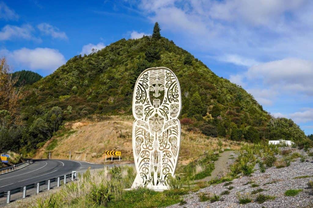
“Three tīpuna figures of te ao kohatu make up the pou which is coated in white paint that symbolizes the mist or kohu that shrouds the steep hill country in the lands of Māhaki.” excerpt from TeAo Maori News.
Now, it’s just over an hour until you are back in Gisborne, driving past vineyards and orchards. Where 10 days ago, we left Gisborne to drive the East Cape.
Now we know what makes the East Cape of New Zealand so special.
See the Best of East Cape, New Zealand
A road trip around the East Cape of New Zealand is definitely one of the bucket list items when planning your exploration of New Zealand.
You are taken back in time, leaving the populous cities to experience small-town New Zealand. Some places are so small there are more settlements where the way of life appears less stressful and more in tune with the environment.
The spectacular rugged coastline, sandy white beaches and nature trails definitely help you unwind and immerse yourself in the experience.
Even the sporadic cell coverage helps you unplug from social media.
We fell asleep with the sound of the surf and woke to a bird chorus.
While the road of SH35 is at times narrow and windy, it’s telling you to slow down and see what East Cape has to offer.
Exploring the East Cape is a memorable travel option you want to do at least once to discover more of Aotearoa, New Zealand.